Monday, July 31, 2006

Space the Final Frontier,

Mission: Hubble Space Telescope (HST) Spitzer Space Telescope (SST), Spacecraft: Hubble Space Telescope Spitzer Space Telescope (SST), Instrument: Infrared Array Camera (IRAC)Visible Light, Product Size: 2905 samples x 1486 lines, Produced By: California Institute of Technology, Full-Res JPEG: PIA08097.jpg (560.3 kB)

Original Caption Released with Image: These shape-shifting galaxies have taken on the form of a giant mask. The icy blue eyes are actually the cores of two merging galaxies, called NGC 2207 and IC 2163, and the mask is their spiral arms. The false-colored image consists of infrared data from NASA's Spitzer Space Telescope (red) and visible data from NASA's Hubble Space Telescope (blue/green).

NGC 2207 and IC 2163 met and began a sort of gravitational tango about 40 million years ago. The two galaxies are tugging at each other, stimulating new stars to form. Eventually, this cosmic ball will come to an end, when the galaxies meld into one. The dancing duo is located 140 million light-years away in the Canis Major constellation.

The infrared data from Spitzer highlight the galaxies' dusty regions, while the visible data from Hubble indicates starlight. In the Hubble-only image (not pictured here), the dusty regions appear as dark lanes.

The Hubble data correspond to light with wavelengths of .44 and .55 microns (blue and green, respectively). The Spitzer data represent light of 8 microns.

Image Credit: NASA/JPL-Caltech/STScI/Vassar

NASA images generally are not copyrighted. Unless otherwise noted, images and video on JPL public web sites (public sites ending with a jpl.nasa.gov address) may be used for any purpose without prior permission. The endorsement of any product or service by Caltech, JPL or NASA must not be claimed or implied.

Leave a comment, make a request, Let this small sampling be a guide to better quality, more plentiful, public domain, royalty free, copyright free, high resolution, images, stock photos, jpeg, jpg, free for commercial use, clip art, clipart, clip-art. more at and or and or and or and or and or

Sunday, July 30, 2006

Space the Final Frontier, Comets

Target Name: Comet, Mission: Spitzer Space Telescope (SST), Spacecraft: Spitzer Space Telescope (SST), Instrument: Multi-band Imaging Photometer, Product Size: 2947 samples x 2035 lines.
Produced By: California Institute of Technology. Full-Res JPEG: PIA08438.jpg (1.157 MB)

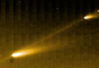
Original Caption Released with Image: This image from NASA's Spitzer Space Telescope shows three of the many fragments making up Comet 73P /Schwassman-Wachmann 3. The infrared picture also provides the best look yet at the crumbling comet's trail of debris, seen here as a bridge connecting the larger fragments.

The comet circles around our sun every 5.4 years. In 1995, it splintered apart into four pieces, labeled A through D, with C being the biggest. Since then, the comet has continued to fracture into dozens of additional pieces. This image is centered about midway between fragments C and B; fragment G can be seen in the upper right corner.

The comet's trail is made of dust, pebbles and rocks left in the comet's wake during its numerous journeys around the sun. Such debris can become the stuff of spectacular meteor showers on Earth.

This image was taken on April 1, 2006, by Spitzer's multi-band imaging photometer using the 24-micron wavelength channel.

Image Credit: NASA/JPL-Caltech

NASA images generally are not copyrighted. Unless otherwise noted, images and video on JPL public web sites (public sites ending with a jpl.nasa.gov address) may be used for any purpose without prior permission. The endorsement of any product or service by Caltech, JPL or NASA must not be claimed or implied.

Leave a comment, make a request, Let this small sampling be a guide to better quality, more plentiful, public domain, royalty free, copyright free, high resolution, images, stock photos, jpeg, jpg, free for commercial use, clip art, clipart, clip-art. more at and or and or and or and or and or

Saturday, July 29, 2006

Space the Final Frontier, Andromeda galaxy

Target Name: Messier 31, Mission: Spitzer Space Telescope (SST), Spacecraft: Spitzer Space Telescope (SST), Instrument: Infrared Array Camera (IRAC).
Target Name: Messier 31, Mission: Spitzer Space Telescope (SST), Spacecraft: Spitzer Space Telescope (SST), Instrument: Infrared Array Camera (IRAC), Product Size: 720 samples x 486 lines, Produced By: California Institute of Technology

The visible-light image highlights the galaxy's population of about one trillion stars. The stars are so crammed into its core that this region blazes with bright starlight.

In contrast, the false-colored Spitzer view reveals red waves of dust against a more tranquil sea of blue stars. The dust lanes can be seen twirling all the way into the galaxy's center. This dust is warmed by young stars and shines at infrared wavelengths , which are represented in red. The blue color signifies shorter-wavelength infrared light primarily from older stars.

The Andromeda galaxy, also known affectionately by astronomers as Messier 31, is located 2.5 million light-years away in the constellation Andromeda. It is the closest major galaxy to the Milky Way, making it the ideal specimen for carefully examining the nature of galaxies. On a clear, dark night, the galaxy can be spotted with the naked eye as a fuzzy blob.

Andromeda's entire disk spans about 260,000 light-years, which means that a light beam would take 260,000 years to travel from one end of the galaxy to the other. By comparison, the Milky Way is about 100,000 light-years across. When viewed from Earth, Andromeda occupies a portion of the sky equivalent to seven full moons.

Because this galaxy is so large, the infrared images had to be stitched together out of about 3,000 separate Spitzer exposures. The light detected by Spitzer's infrared array camera at 3.6 and 4.5 microns is sensitive mostly to starlight and is shown in blue and green, respectively. The 8-micron light shows warm dust and is shown in red. The contribution from starlight has been subtracted from the 8-micron image to better highlight the dust structures.

Image Credit: NASA/JPL-Caltech/Harvard-Smithsonian CfA/NOAO

NASA images generally are not copyrighted. Unless otherwise noted, images and video on JPL public web sites (public sites ending with a jpl.nasa.gov address) may be used for any purpose without prior permission. The endorsement of any product or service by Caltech, JPL or NASA must not be claimed or implied.

Leave a comment, make a request, Let this small sampling be a guide to better quality, more plentiful, public domain, royalty free, copyright free, high resolution, images, stock photos, jpeg, jpg, free for commercial use, clip art, clipart, clip-art. more at and or and or and or and or and or

Friday, July 28, 2006

Space the Final Frontier, Supernova

Mission: Spitzer Space Telescope (SST), Spacecraft: Spitzer Space Telescope (SST), Instrument: Infrared Array Camera (IRAC), Product Size: 2325 samples x 2329 lines.Mission: Spitzer Space Telescope (SST), Spacecraft: Spitzer Space Telescope (SST), Instrument: Infrared Array Camera (IRAC), Product Size: 2325 samples x 2329 lines. Produced By: California Institute of Technology, Full-Res JPEG: PIA08533.jpg (325.5 kB)
This image is the galaxy M74, as seen by Spitzer's infrared array camera. The white box (see figure 1) to the left of the galaxy's center identifies the location of the supernova remnant. In all the images, the blue dots represent hot gas and stars. The galaxy's cool dust is shown in red.

Astronomers using NASA's Spitzer Space Telescope have spotted a "dust factory" 30 million light-years away in the spiral galaxy M74. The factory is located at the scene of a massive star's explosive death, or supernova.

While astronomers have suspected for years that supernovae could be producers of cosmic dust particles, the technology to confirm this suspicion has only recently become available.

The dust factory, also known as supernova SN 2003gd, is shown at the center of the two small insets from Spitzer's infrared array camera. A white arrow points to its exact location (see figure 1). The yellow-green dot shown in the July 2004 inset (see figure 2) shows that the source's temperature is warmer than the surrounding material. This is because newly formed dust within the supernova is just starting to cool. By January 2005, the dust had cooled and completely faded from the camera's view (see figure 3). However, it was still detected in January 2005 by another instrument aboard Spitzer called the multiband imaging photometer. The image from that instrument is not shown here.

The images are false-color, infrared composites, in which 3.6-micron light is blue, 4.5-micron light is green, and 8-micron light is red.

Image Credit: NASA/JPL-Caltech/STScI

NASA images generally are not copyrighted. Unless otherwise noted, images and video on JPL public web sites (public sites ending with a jpl.nasa.gov address) may be used for any purpose without prior permission. The endorsement of any product or service by Caltech, JPL or NASA must not be claimed or implied.

Leave a comment, make a request, Let this small sampling be a guide to better quality, more plentiful, public domain, royalty free, copyright free, high resolution, images, stock photos, jpeg, jpg, free for commercial use, clip art, clipart, clip-art. more at and or and or and or and or and or

Thursday, July 27, 2006

Space the Final Frontier, Black Hole

Space Telescope (HST), Spitzer Space Telescope (SST), Spacecraft: Chandra X-ray Telescope, Hubble Space Telescope, Spitzer Space Telescope (SST)
Mission: Hubble Space Telescope (HST)Spitzer Space Telescope (SST), Spacecraft: Chandra X-ray TelescopeHubble Space TelescopeSpitzer Space Telescope (SST), Instrument: Infrared Array Camera (IRAC)Visible Light, Product Size: 900 samples x 360 lines, Produced By: California Institute of Technology, Full-Res JPEG: PIA08617.jpg (10.56 kB)

Original Caption Released with Image: This new false-colored image from NASA's Hubble, Chandra and Spitzer space telescopes shows a giant jet of particles that has been shot out from the vicinity of a type of supermassive black hole called a quasar. The jet is enormous, stretching across more than 100,000 light-years of space -- a size comparable to our own Milky Way galaxy!

Quasars are among the brightest objects in the universe. They consist of supermassive black holes surrounded by turbulent material, which is being heated up as it is dragged toward the black hole. This hot material glows brilliantly, and some of it gets blown off into space in the form of powerful jets.

The jet pictured here is streaming out from the first known quasar, called 3C273, discovered in 1963. A kaleidoscope of colors represents the jet's assorted light waves. X-rays, the highest-energy light in the image, are shown at the far left in blue (the black hole itself is well to the left of the image). The X-rays were captured by Chandra. As you move from left to right, the light diminishes in energy, and wavelengths increase in size. Visible light recorded by Hubble is displayed in green, while infrared light caught by Spitzer is red. Areas where visible and infrared light overlap appear yellow.

Image Credit: NASA/JPL-Caltech/Yale Univ.

NASA images generally are not copyrighted. Unless otherwise noted, images and video on JPL public web sites (public sites ending with a jpl.nasa.gov address) may be used for any purpose without prior permission. The endorsement of any product or service by Caltech, JPL or NASA must not be claimed or implied.

Leave a comment, make a request, Let this small sampling be a guide to better quality, more plentiful, public domain, royalty free, copyright free, high resolution, images, stock photos, jpeg, jpg, free for commercial use, clip art, clipart, clip-art. more at and or and or and or and or and or

Wednesday, July 26, 2006

Space the Final Frontier, Stars Can't Spin Out of Control

Mission: Spitzer Space Telescope (SST), Spacecraft: Spitzer Space Telescope (SST), Product Size: 3200 samples x 2400 lines.Mission: Spitzer Space Telescope (SST), Spacecraft:
Spitzer Space Telescope (SST), Product Size: 3200 samples x 2400 lines.
Produced By: California Institute of Technology, Full-Res JPEG: PIA08626.jpg (714.7 kB)

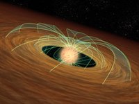
Original Caption Released with Image: This artist's animation demonstrates how a dusty planet-forming disk can slow down a whirling young star, essentially saving the star from spinning itself to death. Evidence for this phenomenon comes from NASA's Spitzer Space Telescope.

The movie begins by showing a developing star (red ball). The star is basically a giant ball of gas that is collapsing onto itself. As it shrinks, it spins faster and faster, like a skater folding in his or her arms. The green lines represent magnetic fields.

As gravity continues to pull matter inward, the star spins so fast, it starts to flatten out. The same principle applies to the planet Saturn, whose spin has caused it to be slightly squashed or oblate.

A forming star can theoretically whip around fast enough to overcome gravity and flatten itself into a state where it can no longer become a full-fledged star. But stars don't spin out of control, possibly because swirling disks of dust slow them down. Such disks can be found orbiting young stars, and are filled with dust that might ultimately stick together to form planets.

The second half of the animation demonstrates how a disk is thought to keep its star's speed in check. A developing star is shown twirling inside its disk. As it turns, its magnetic fields pass through the disk and get bogged down like a spoon in molasses. This locks the star's rotation to the slower-turning disk, so the star, while continuing to shrink, does not spin faster.

Spitzer found evidence for star-slowing disks in a survey of nearly 500 forming stars in the Orion nebula. It observed that slowly spinning stars are five times more likely to host disks than rapidly spinning stars.

Image Credit: NASA/JPL-Caltech.

NASA images generally are not copyrighted. Unless otherwise noted, images and video on JPL public web sites (public sites ending with a jpl.nasa.gov address) may be used for any purpose without prior permission. The endorsement of any product or service by Caltech, JPL or NASA must not be claimed or implied.

Leave a comment, make a request, Let this small sampling be a guide to better quality, more plentiful, public domain, royalty free, copyright free, high resolution, images, stock photos, jpeg, jpg, free for commercial use, clip art, clipart, clip-art. more at and or and or and or and or and or

Tuesday, July 25, 2006

Space the Final Frontier, Pluto and Charon

Target Name: Pluto, Is a satellite of: Sol (our sun), Mission: Hubble Space Telescope (HST)Target Name: Pluto, Is a satellite of: Sol (our sun)Mission: Hubble Space Telescope (HST).
Spacecraft: Hubble Space Telescope, Instrument: Wide Field Planetary Camera 2, Product Size: 950 samples x 494 lines, Produced By: ESA/ESO Space Telescope European, Producer ID: STSCI-PR94-17MRPS87787, Addition Date:
1998-03-28, Primary Data Set: Space Telescope Science Institute, Full-Res JPEG: PIA00827.jpg (10.7 kB)

Original Caption Released with Image:
This is the clearest view yet of the distant planet Pluto and its moon, Charon, as revealed by NASA's Hubble Space Telescope (HST). The image was taken by the European Space Agency's Faint Object Camera on February 21, 1994 when the planet was 2.6 billion miles (4.4 billion kilometers) from Earth; or nearly 30 times the separation between Earth and the sun.
Hubble's corrected optics show the two objects as clearly separate and sharp disks. This now allows astronomers to measure directly (to within about 1 percent) Pluto's diameter of 1440 miles (2320 kilometers) and Charon's diameter of 790 miles (1270 kilometers).

The Hubble observations show that Charon is bluer than Pluto. This means that both worlds have different surface composition and structure. A bright highlight on Pluto suggests it has a smoothly reflecting surface layer.

A detailed analysis of the Hubble image also suggests there is a bright area parallel to the equator on Pluto. This result is consistent with surface brightness models based on previous ground-based photometric observations. However, subsequent HST observations will be required to confirm whether the feature is real.

Though Pluto was discovered in 1930, Charon wasn't detected until 1978. That is because the moon is so close to Pluto that the two worlds are typically blurred together when viewed through ground-based telescopes. (If our moon were as close to Earth, it would be as big in the night sky as an apple held at arm's length). The new HST image was taken when Charon was near its maximum elongation from Pluto of .9 arc seconds. The two worlds are 12,200 miles apart (19,640 kilometers).

Hubble's ability to distinguish Pluto's disk at a distance of 2.6 billion miles (4.4 billion kilometers) is equivalent to seeing a baseball at a distance of 40 miles (64 kilometers).

Pluto typically is called the double planet because Charon is half the diameter of Pluto (our Moon is one-quarter the diameter of Earth).

This image and other images and data received from the Hubble Space Telescope are posted on the World Wide Web on the Space Telescope Science Institute home page at URL oposite.stsci.edu/pubinfo/

Image Credit: Dr. R. Albrecht, ESA/ESO Space Telescope European Coordinating Facility; NASA.

NASA images generally are not copyrighted. Unless otherwise noted, images and video on JPL public web sites (public sites ending with a jpl.nasa.gov address) may be used for any purpose without prior permission. The endorsement of any product or service by Caltech, JPL or NASA must not be claimed or implied.

Leave a comment, make a request, Let this small sampling be a guide to better quality, more plentiful, public domain, royalty free, copyright free, high resolution, images, stock photos, jpeg, jpg, free for commercial use, clip art, clipart, clip-art. more at and or and or and or and or and or and

Monday, July 24, 2006

Space the Final Frontier, Neptune, Triton

Target Name: Triton, Is a satellite of: Neptune, Mission: Voyager, Spacecraft: Voyager 2, Product Size: 1300 samples x 1280 lines.Target Name: Triton, Is a satellite of: Neptune, Mission: Voyager, Spacecraft: Voyager 2, Product Size: 1300 samples x 1280 line. Produced By: U.S. Geological Survey, Addition Date: 1998-06-04, Primary Data Set: Voyager EDRs
Full-Res JPEG: PIA00344.jpg (143.2 kB)

Original Caption Released with Image: Composite view showing Neptune on Triton's horizon. Neptune's south pole is to the left; clearly visible in the planets' southern hemisphere is a Great Dark Spot, a large anticyclonic storm system located about 20 degrees South. The foreground is a computer generated view of Triton's maria as they would appear from a point approximately 45 km above the surface. The terraces visible in this image indicate multiple episodes of 'cryovolcanic' flooding.

This three-dimensional view was created from a Voyager image by using a two-dimensional photoclinometric model. Relief has been exaggerated roughly 30-fold, the actual range of the relief is about 1 km. Would Neptune appear to be rising or setting? Neither, due to the motion of Triton relative to Neptune, it would appear to move laterally along the horizon, eventually rising and setting at high latitudes.

NASA images generally are not copyrighted. Unless otherwise noted, images and video on JPL public web sites (public sites ending with a jpl.nasa.gov address) may be used for any purpose without prior permission. The endorsement of any product or service by Caltech, JPL or NASA must not be claimed or implied.

Leave a comment, make a request, Let this small sampling be a guide to better quality, more plentiful, public domain, royalty free, copyright free, high resolution, images, stock photos, jpeg, jpg, free for commercial use, clip art, clipart, clip-art. more at and or and or and or and or and or and

Sunday, July 23, 2006

Space the Final Frontier, Neptune Rings

Target Name: N Rings, Is a satellite of: Neptune, Mission: Voyager, Spacecraft: Voyager 2, Instrument: Imaging Science Subsystem - Narrow Angle, Product Size: 300 samples x 512 lines.Target Name: N Rings, Is a satellite of: Neptune, Mission: Voyager, Spacecraft: Voyager 2, Instrument: Imaging Science Subsystem - Narrow Angle, Product Size: 300 samples x 512 lines.
Produced By: JPL, Producer ID: P34725, Primary Data Set: Voyager EDRs, Full-Res JPEG: PIA02224.jpg (58.83 kB)
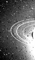
Original Caption Released with Image: This 591-second exposure of the rings of Neptune were taken with the clear filter by the Voyager 2 wide-angle camera. The two main rings are clearly visible and appear complete over the region imaged. Also visible in this image is the inner faint ring and the faint band which extends smoothly from the ring roughly halfway between the two bright rings.

Both of these newly discovered rings are broad and much fainter than the two narrow rings. The bright glare is due to over-exposure of the crescent on Neptune. Numerous bright stars are evident in the background. Both bright rings have material throughout their entire orbit, and are therefore continuous. The Voyager Mission is conducted by JPL for NASA's Office of Space Science and Applications.

NASA images generally are not copyrighted. Unless otherwise noted, images and video on JPL public web sites (public sites ending with a jpl.nasa.gov address) may be used for any purpose without prior permission. The endorsement of any product or service by Caltech, JPL or NASA must not be claimed or implied.

Technorati tags: and or and or and or and or and or

Saturday, July 22, 2006

Space the Final Frontier, Neptune

Target Name: Neptune, Is a satellite of: Sol (our sun), Mission: Voyager, Spacecraft: Voyager 2, Product Size: 2188 samples x 2185 lines.Target Name: Neptune, Is a satellite of: Sol (our sun), Mission: Voyager, Spacecraft: Voyager 2, Product Size: 2188 samples x 2185 lines. Produced By: JPL, Producer ID: P35669. Addition Date: 1998-10-30, Primary Data Set: Voyager EDRs, Full-Res JPEG: PIA01492.jpg (259 kB)
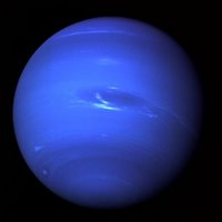
Original Caption Released with Image: This picture of Neptune was produced from the last whole planet images taken through the green and orange filters on the Voyager 2 narrow angle camera. The images were taken at a range of 4.4 million miles from the planet, 4 days and 20 hours before closest approach.

The picture shows the Great Dark Spot and its companion bright smudge; on the west limb the fast moving bright feature called Scooter and the little dark spot are visible. These clouds were seen to persist for as long as Voyager's cameras could resolve them. North of these, a bright cloud band similar to the south polar streak may be seen.

The Voyager Mission is conducted by JPL for NASA's Office of Space Science and Applications

NASA images generally are not copyrighted. Unless otherwise noted, images and video on JPL public web sites (public sites ending with a jpl.nasa.gov address) may be used for any purpose without prior permission. The endorsement of any product or service by Caltech, JPL or NASA must not be claimed or implied.

Leave a comment, make a request, Let this small sampling be a guide to better quality, more plentiful, public domain, royalty free, copyright free, high resolution, images, stock photos, jpeg, jpg, free for commercial use, clip art, clipart, clip-art. more at and or and or and or and or and or

Friday, July 21, 2006

Space the Final Frontier, Uranus, Rings

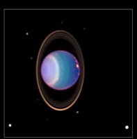
Target Name: Uranus, Is a satellite of: Sol (our sun), Mission: Hubble Space Telescope (HST), Spacecraft: Hubble Space Telescope, Instrument: Wide Field Planetary Camera 2, Product Size: 2400 samples x 2433 lines.Target Name: Uranus, Is a satellite of: Sol (our sun), Mission: Hubble Space Telescope (HST), Spacecraft: Hubble Space Telescope, Instrument: Wide Field Planetary Camera 2, Product Size: 2400 samples x 2433 lines.
Produced By: Space Telescope Science Institute, Producer ID: STSCI-PRC98-35, Addition Date: 2000-08-24, Primary Data Set: Space Telescope Science Institute, Full-Res JPEG: PIA02963.jpg (170.8 kB)

Original Caption Released with Image: A recent Hubble Space Telescope view reveals Uranus surrounded by its four major rings and by 10 of its 17 known satellites. This false-color image was generated by Erich Karkoschka using data taken on August 8, 1998, with Hubble's Near Infrared Camera and Multi-Object Spectrometer. Hubble recently found about 20 clouds - nearly as many clouds on Uranus as the previous total in the history of modern observations.

The Wide Field/Planetary Camera 2 was developed by the Jet Propulsion Laboratory and managed by the Goddard Spaced Flight Center for NASA's Office of Space Science.

This image and other images and data received from the Hubble Space Telescope are posted on the World Wide Web on the Space Telescope Science Institute home page at URL oposite.stsci.edu/pubinfo/

NASA images generally are not copyrighted. Unless otherwise noted, images and video on JPL public web sites (public sites ending with a jpl.nasa.gov address) may be used for any purpose without prior permission. The endorsement of any product or service by Caltech, JPL or NASA must not be claimed or implied.

Leave a comment, make a request, Let this small sampling be a guide to better quality, more plentiful, public domain, royalty free, copyright free, high resolution, images, stock photos, jpeg, jpg, free for commercial use, clip art, clipart, clip-art. more at and or and or and or and or and or

Thursday, July 20, 2006

Space the Final Frontier, Uranus, Oberon

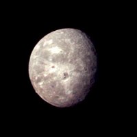
Target Name: Oberon, Is a satellite of: Uranus, Mission: Voyager, Spacecraft: Voyager 2, Product Size: 500 samples x 500 lines.Target Name: Oberon, Is a satellite of: Uranus, Mission: Voyager, Spacecraft: Voyager 2, Product Size: 500 samples x 500 lines. Produced By: JPL, Producer ID: P29501, Addition Date: 1996-01-29
Primary Data Set: Voyager EDRs, Full-Res JPEG: PIA00034.jpg (14.1 kB)

Original Caption Released with Image: This Voyager 2 picture of Oberon is the best the spacecraft acquired of Uranus' outermost moon. The picture was taken shortly after 3:30 a.m. PST on Jan. 24, 1986, from a distance of 660,000 kilometers (410,000 miles). The color was reconstructed from images taken through the narrow-angle camera's violet, clear and green filters. The picture shows features as small as 12 km (7 mi) on the moon's surface.

Clearly visible are several large impact craters in Oberon's icy surface surrounded by bright rays similar to those seen on Jupiter's moon Callisto. Quite prominent near the center of Oberon's disk is a large crater with a bright central peak and a floor partially covered with very dark material.

This may be icy, carbon-rich material erupted onto the crater floor sometime after the crater formed. Another striking topographic feature is a large mountain, about 6 km (4 mi) high, peeking out on the lower left limb. The Voyager project is managed for NASA by the Jet Propulsion Laboratory.

NASA images generally are not copyrighted. Unless otherwise noted, images and video on JPL public web sites (public sites ending with a jpl.nasa.gov address) may be used for any purpose without prior permission. The endorsement of any product or service by Caltech, JPL or NASA must not be claimed or implied.

Leave a comment, make a request, Let this small sampling be a guide to better quality, more plentiful, public domain, royalty free, copyright free, high resolution, images, stock photos, jpeg, jpg, free for commercial use, clip art, clipart, clip-art. more at and or and or and or and or and or

Wednesday, July 19, 2006

Space the Final Frontier, Uranus, Miranda

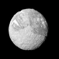
Target Name: Miranda, Is a satellite of: Uranus, Mission: Voyager, Spacecraft: Voyager 2, Product Size: 595 samples x 595 lines.Target Name: Miranda, Is a satellite of: Uranus, Mission: Voyager, Spacecraft: Voyager 2, Product Size: 595 samples x 595 lines. Produced By: JPL, Producer ID: 2601654,
Primary Data Set: Voyager EDRs, Full-Res JPEG: PIA02217.jpg (21.6 kB)
Original Caption Released with Image: Mosaic of high-resolution images of Miranda. One wide-angle and eight narrow-angle camera images of Miranda were combined in this view. The controlled mosaic was transformed to an orthographic view centered on the south pole. The trapezoidal region (about 200 km on a side) occurs near the south pole and is located near the center of the mosaic. The trapezoid's outer boundary and its internal patterns of ridges and band of contrasting albedo display numerous sharp corners.

NASA images generally are not copyrighted. Unless otherwise noted, images and video on JPL public web sites (public sites ending with a jpl.nasa.gov address) may be used for any purpose without prior permission. The endorsement of any product or service by Caltech, JPL or NASA must not be claimed or implied.

Leave a comment, make a request, Let this small sampling be a guide to better quality, more plentiful, public domain, royalty free, copyright free, high resolution, images, stock photos, jpeg, jpg, free for commercial use, clip art, clipart, clip-art. more at and or and or and or and or and or

Monday, July 17, 2006

Space the Final Frontier, Uranus, Ariel

Target Name: Ariel, Is a satellite of: Uranus, Mission: Voyager, Spacecraft: Voyager 2, Instrument: Imaging Science Subsystem - Narrow Angle, Product Size: 845 samples x 650 lines.Target Name: Ariel, Is a satellite of: Uranus, Mission: Voyager, Spacecraft: Voyager 2, Instrument: Imaging Science Subsystem - Narrow Angle, Product Size: 845 samples x 650 lines.
Produced By: JPL, Producer ID: P29523, Addition Date: 1996-01-29, Primary Data Set: Voyager EDRs, Full-Res JPEG: PIA00041.jpg (45.92 kB)

Original Caption Released with Image: The complex terrain of Ariel is viewed in this image, the best Voyager 2 color picture of the Uranian moon. The individual photos used to construct this composite were taken Jan. 24, 1986, from a distance of 170,000 kilometers (105,000 miles. Voyager captured this view of Ariel's southern hemisphere through the green, blue and violet filters of the narrow-angle camera; the resolution is about 3 km (2 mi).

Most of the visible surface consists of relatively intensely cratered terrain transected by fault scarps and fault-bounded valleys (graben). Some of the largest valleys, which can be seen near the terminator (at right), are partly filled with younger deposits that are less heavily cratered. Bright spots near the limb and toward the left are chiefly the rims of small craters. Most of the brightly rimmed craters are too small to be resolved here, although one about 30 km (20 mi) in diameter can be easily distinguished near the center.

These bright-rim craters, though the youngest features on Ariel, probably have formed over a long span of geological time. Although Ariel has a diameter of only about 1,200 km (750 mi), it has clearly experienced a great deal of geological activity in the past. The Voyager project is managed for NASA by the Jet Propulsion Laboratory.

NASA images generally are not copyrighted. Unless otherwise noted, images and video on JPL public web sites (public sites ending with a jpl.nasa.gov address) may be used for any purpose without prior permission. The endorsement of any product or service by Caltech, JPL or NASA must not be claimed or implied.

Leave a comment, make a request, Let this small sampling be a guide to better quality, more plentiful, public domain, royalty free, copyright free, high resolution, images, stock photos, jpeg, jpg, free for commercial use, clip art, clipart, clip-art. more at and or and or and or and or and or

Sunday, July 16, 2006

Space the Final Frontier, Uranus

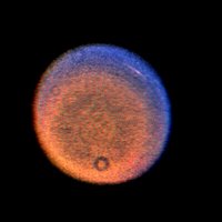
Target Name: Uranus, Is a satellite of: Sol (our sun), Mission: Voyager, Spacecraft: Voyager 2, Instrument: Imaging Science Subsystem - Narrow Angle, Product Size: 700 samples x 700 linesTarget Name: Uranus, Is a satellite of: Sol (our sun), Mission: Voyager, Spacecraft: Voyager 2, Instrument: Imaging Science Subsystem - Narrow Angle, Product Size: 700 samples x 700 lines.
Produced By: JPL, Producer ID: P29468, Addition Date: 1996-11-26, Primary Data Set: Voyager EDRs, Full-Res JPEG: PIA00370.jpg (38.42 kB)

Original Caption Released with Image: This false-color Voyager picture of Uranus shows a discrete cloud seen as a bright streak near the planet's limb. The picture is a highly processed composite of three images obtained Jan. 14, 1986, when the spacecraft was 12.9 million kilometers (8.0 million miles) from the planet. The cloud visible here is the most prominent feature seen in a series of Voyager images designed to track atmospheric motions.

(The occasional donut-shaped features, including one at the bottom, are shadows cast by dust in the camera optics; the processing necessary to bring out the faint features on the planet also brings out these camera blemishes.) Three separate images were shuttered through violet, blue and orange filters. Each color image showed the cloud to a different degree; because they were not exposed at exactly the same time, the images were processed to provide a correction for a good spatial match.

In a true-color image, the cloud would be barely discernible; the false color helps bring out additional details. The different colors imply variations in vertical structure, but as yet is not possible to be specific about such differences. One possibility is that the Uranian atmosphere contains smog-like constituents, in which case some color differences may represent differences in how these molecules are distributed. The Voyager project is managed for NASA by the Jet Propulsion Laboratory.

NASA images generally are not copyrighted. Unless otherwise noted, images and video on JPL public web sites (public sites ending with a jpl.nasa.gov address) may be used for any purpose without prior permission. The endorsement of any product or service by Caltech, JPL or NASA must not be claimed or implied.

Leave a comment, make a request, Let this small sampling be a guide to better quality, more plentiful, public domain, royalty free, copyright free, high resolution, images, stock photos, jpeg, jpg, free for commercial use, clip art, clipart, clip-art. more at and or and or and or and or and

Saturday, July 15, 2006

Space the Final Frontier, Saturn, Titan

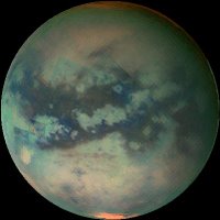
Target Name: Titan, Is a satellite of: Saturn, Mission: Cassini, Spacecraft: Cassini Orbiter, Instrument: Visual and Infrared Mapping Spectrometer, Product Size: 402 samples x 402 lines.
Produced By: University of Arizona / LPL, Primary Data Set: Cassini, Full-Res JPEG: PIA02146.jpg (19.26 kB)

Original Caption Released with Image: This movie of Titan (click here), shows data taken with Cassini's visual and infrared mapping spectrometer during the last three flybys of Titan. The flybys took place on Oct. 28, 2005, Dec. 26, 2005, and Jan. 15, 2006.

These false-color images were taken at wavelengths of 1.6 microns shown in blue, 2.01 microns in green and 5 microns in red.

The viewing geometry of the December flyby is roughly on the opposite hemispheres of the flybys in October and January. There are several important features shown by the movie. First, the globe of Titan exhibits two major types of terrain. One is very bright, and a darker one seems to be concentrated near the equator. Titan also has two very bright regions, the large one known as Tui Reggio, and the other as Hotei Arcus. These regions are thought to be surface deposits, probably of volcanic origin, and may be water and/or carbon dioxide frozen from the vapor. The December flyby data show that the western margins of Tui Reggio have a complex flow-like structure consistent with eruptive phenomena. The reddish feature at the south pole is Titan's south polar cloud system, which was very bright during the December flyby. During the October and January flybys it is barely visible, indicating that the atmosphere over titan's south pole is very dynamic.

The Cassini-Huygens mission is a cooperative project of NASA, the European Space Agency and the Italian Space Agency. The Jet Propulsion Laboratory, a division of the California Institute of Technology in Pasadena, manages the mission for NASA's Science Mission Directorate, Washington, D.C. The Cassini orbiter was designed, developed and assembled at JPL. The visual and infrared mapping spectrometer team is based at the University of Arizona.

For more information about the Cassini-Huygens mission saturn.jpl.nasa.gov/ The visual and infrared mapping spectrometer team homepage is at vims.lpl.arizona.edu. Image Credit: NASA/JPL/University of Arizona

NASA images generally are not copyrighted. Unless otherwise noted, images and video on JPL public web sites (public sites ending with a jpl.nasa.gov address) may be used for any purpose without prior permission. The endorsement of any product or service by Caltech, JPL or NASA must not be claimed or implied.

Leave a comment, make a request, Let this small sampling be a guide to better quality, more plentiful, public domain, royalty free, copyright free, high resolution, images, stock photos, jpeg, jpg, free for commercial use, clip art, clipart, clip-art. more at and or and or and or and or and

Friday, July 14, 2006

Space the Final Frontier, Saturn, Tethys

Target Name: Tethys, Is a satellite of: Saturn, Mission: Cassini, Spacecraft: Cassini Orbiter, Instrument: Imaging Science Subsystem - Narrow Angle, Product Size: 1220 samples x 798 lines.Target Name: Tethys, Is a satellite of: Saturn, Mission: Cassini, Spacecraft: Cassini Orbiter, Instrument: Imaging Science Subsystem - Narrow Angle, Product Size: 1220 samples x 798 lines.
Produced By: Cassini Imaging Team, Primary Data Set: Cassini, Full-Res JPEG: PIA07693.jpg (95.57 kB)

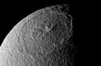
Original Caption Released with Image: Plunging cliffs and towering mountains characterize the gigantic impact structure called Odysseus on Saturn's moon Tethys. The great impact basin lies before the Cassini spacecraft in one of the best views yet obtained.

Quite a few small craters are visible inside Odysseus (450 kilometers, or 280 miles across), making it clear that this is not a very young structure. However, a comparison of cratering density between the interior of Odysseus and the surrounding terrain should show whether the large basin is at least relatively young.

Odysseus is on the leading hemisphere of Tethys (1,071 kilometers, or 665 miles across). North is up and rotated 18 degrees to the right.

The image was taken in polarized ultraviolet light with the Cassini spacecraft narrow-angle camera on Dec. 24, 2005 at a distance of approximately 196,000 kilometers (122,000 miles) from Tethys and at a Sun-Tethys-spacecraft, or phase, angle of 85 degrees. Resolution in the original image was 1 kilometer (3,831 feet) per pixel. The image has been magnified by a factor of two and contrast-enhanced to aid visibility.

The Cassini-Huygens mission is a cooperative project of NASA, the European Space Agency and the Italian Space Agency. The Jet Propulsion Laboratory, a division of the California Institute of Technology in Pasadena, manages the mission for NASA's Science Mission Directorate, Washington, D.C. The Cassini orbiter and its two onboard cameras were designed, developed and assembled at JPL. The imaging operations center is based at the Space Science Institute in Boulder, Colo.

For more information about the Cassini-Huygens mission visit saturn.jpl.nasa.gov. The Cassini imaging team homepage is at ciclops.org. Image Credit: NASA/JPL/Space Science Institute

NASA images generally are not copyrighted. Unless otherwise noted, images and video on JPL public web sites (public sites ending with a jpl.nasa.gov address) may be used for any purpose without prior permission. The endorsement of any product or service by Caltech, JPL or NASA must not be claimed or implied.

Technorati tags: and or and or and or and or and

Thursday, July 13, 2006

Space the Final Frontier, Saturn, Telesto

Target Name: Telesto, Is a satellite of: Saturn, Mission: Cassini, Spacecraft: Cassini Orbiter, Instrument: Imaging Science Subsystem - Narrow Angle, Product Size: 399 samples x 329 lines.Target Name: Telesto, Is a satellite of: Saturn, Mission: Cassini, Spacecraft: Cassini Orbiter, Instrument: Imaging Science Subsystem - Narrow Angle, Product Size: 399 samples x 329 lines.
Produced By: Cassini Imaging Team, Primary Data Set: Cassini, Full-Res JPEG: PIA07697.jpg (7.291 kB)

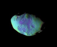
Original Caption Released with Image: These views show surface features and color variation on the Trojan moon Telesto. The smooth surface of this moon suggests that, like Pandora, it is covered with a mantle of fine, dust-sized icy material.

The monochrome image was taken in visible light (see PIA07696). To create the false-color view, ultraviolet, green and infrared images were combined into a single black and white picture that isolates and maps regional color differences. This "color map" was then superposed over a clear-filter image. The origin of the color differences is not yet understood, but may be caused by subtle differences in the surface composition or the sizes of grains making up the icy soil.

Tiny Telesto is a mere 24 kilometers (15 miles) wide.

The image was acquired with the Cassini spacecraft narrow-angle camera on Dec. 25, 2005 at a distance of approximately 20,000 kilometers (12,000 miles) from Telesto and at a Sun-Telesto-spacecraft, or phase, angle of 58 degrees. Image scale is 118 meters (387 feet) per pixel.

The Cassini-Huygens mission is a cooperative project of NASA, the European Space Agency and the Italian Space Agency. The Jet Propulsion Laboratory, a division of the California Institute of Technology in Pasadena, manages the mission for NASA's Science Mission Directorate, Washington, D.C. The Cassini orbiter and its two onboard cameras were designed, developed and assembled at JPL. The imaging operations center is based at the Space Science Institute in Boulder, Colo.

For more information about the Cassini-Huygens mission visit saturn.jpl.nasa.gov. The Cassini imaging team homepage is at ciclops.org. Image Credit: NASA/JPL/Space Science Institute

NASA images generally are not copyrighted. Unless otherwise noted, images and video on JPL public web sites (public sites ending with a jpl.nasa.gov address) may be used for any purpose without prior permission. The endorsement of any product or service by Caltech, JPL or NASA must not be claimed or implied.

Leave a comment, make a request, Let this small sampling be a guide to better quality, more plentiful, public domain, royalty free, copyright free, high resolution, images, stock photos, jpeg, jpg, free for commercial use, clip art, clipart, clip-art. more at and or and or and or and or and

Wednesday, July 12, 2006

Space the Final Frontier, Saturn, S-Rings

Target Name: S Rings, Is a satellite of: Saturn, Mission: Cassini, Spacecraft: Cassini Orbiter, Instrument: Imaging Science Subsystem - Narrow Angle, Product Size: 1018 samples x 1016 lines.Target Name: S Rings, Is a satellite of: Saturn, Mission: Cassini, Spacecraft: Cassini Orbiter, Instrument: Imaging Science Subsystem - Narrow Angle, Product Size: 1018 samples x 1016 lines.
Produced By: Cassini Imaging Team, Primary Data Set: Cassini, Full-Res JPEG: PIA07631.jpg (75.78 kB)

Original Caption Released with Image: The dark Cassini Division, within Saturn's rings, contains a great deal of structure, as seen in this color image. The sharp inner boundary of the division (left of center) is the outer edge of the massive B ring and is maintained by the gravitational influence of the moon Mimas.

Spectroscopic observations by Cassini indicate that the Cassini Division, similar to the C ring, contains more contaminated ice than do the B and A rings on either side.

This view is centered on a region approximately 118,500 kilometers (73,600 miles) from Saturn's center. (Saturn is 120,500-kilometers-wide (74,900 miles) at its equator.) From left to right, the image spans approximately 11,000 kilometers (6,800 miles) across the ringplane.

A closer view of the outer edge of the Cassini Division can be seen in PIA07616).

Images taken using red, green and blue spectral filters were combined to create this view, which approximates what the human eye might see. The image was taken with the Cassini spacecraft narrow-angle camera on May 18, 2005, at a distance of approximately 1.6 million kilometers (1 million miles) from Saturn. The image scale is 9 kilometers (6 miles) per pixel.

The Cassini-Huygens mission is a cooperative project of NASA, the European Space Agency and the Italian Space Agency. The Jet Propulsion Laboratory, a division of the California Institute of Technology in Pasadena, manages the mission for NASA's Science Mission Directorate, Washington, D.C. The Cassini orbiter and its two onboard cameras were designed, developed and assembled at JPL. The imaging operations center is based at the Space Science Institute in Boulder, Colo.

For more information about the Cassini-Huygens mission visit saturn.jpl.nasa.gov. The Cassini imaging team homepage is at ciclops.org. Image Credit: NASA/JPL/Space Science Institute

NASA images generally are not copyrighted. Unless otherwise noted, images and video on JPL public web sites (public sites ending with a jpl.nasa.gov address) may be used for any purpose without prior permission. The endorsement of any product or service by Caltech, JPL or NASA must not be claimed or implied.

Leave a comment, make a request, Let this small sampling be a guide to better quality, more plentiful, public domain, royalty free, copyright free, high resolution, images, stock photos, jpeg, jpg, free for commercial use, clip art, clipart, clip-art. more at and or and or and or and or

Tuesday, July 11, 2006

Space the Final Frontier, Saturn, Rhea

Target Name: Rhea, Is a satellite of: Saturn, Mission: Cassini, Spacecraft: Cassini Orbiter, Instrument: Imaging Science Subsystem - Narrow Angle, Product Size: 1124 samples x 1124 lines.
Produced By: Cassini Imaging Team, Primary Data Set: Cassini, Full-Res JPEG: PIA08120.jpg (169.1 kB)

Original Caption Released with Image:
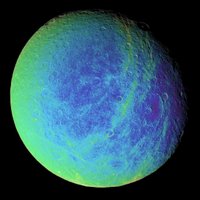
Bright, wispy markings stretch across a region of darker terrain on Saturn's moon Rhea. In this extreme false-color view, the roughly north-south fractures occur within strips of material (which appear greenish here) that are a different color from the surrounding cratered landscape.

To create the false-color view, ultraviolet, green and infrared images were combined into a single black and white picture that isolates and maps regional color differences. Most of the large-scale variations in brightness across the surface are removed by this process. This "color map" was then superimposed over a clear-filter image.

The origin of the color differences is not yet understood, but it may be caused by subtle differences in the surface composition or grain sizes making up the icy soil.

Wispy markings were seen on the trailing hemispheres of both Rhea and Dione in images taken by NASA's Voyager spacecraft, and were hypothesized by some researchers to be the result of material extruded onto the surface by ice volcanism. Cassini's earlier revelation of the braided fractures on Dione led to speculation that Rhea's wisps might also be created by fractures.

This view shows terrain on the trailing hemisphere of Rhea (1,528 kilometers, or 949 miles across). North is up.

The image was taken using the Cassini spacecraft narrow-angle camera on Jan. 17, 2006, at a distance of approximately 245,000 kilometers (152,000 miles) from Rhea and at a Sun-Rhea-spacecraft, or phase, angle of 30 degrees. Image scale is 1 kilometer (4,771 feet) per pixel.

The Cassini-Huygens mission is a cooperative project of NASA, the European Space Agency and the Italian Space Agency. The Jet Propulsion Laboratory, a division of the California Institute of Technology in Pasadena, manages the mission for NASA's Science Mission Directorate, Washington, D.C. The Cassini orbiter and its two onboard cameras were designed, developed and assembled at JPL. The imaging operations center is based at the Space Science Institute in Boulder, Colo.

For more information about the Cassini-Huygens mission visit saturn.jpl.nasa.gov/. The Cassini imaging team homepage is at ciclops.org. Image Credit: NASA/JPL/Space Science Institute

NASA images generally are not copyrighted. Unless otherwise noted, images and video on JPL public web sites (public sites ending with a jpl.nasa.gov address) may be used for any purpose without prior permission. The endorsement of any product or service by Caltech, JPL or NASA must not be claimed or implied.

Leave a comment, make a request, Let this small sampling be a guide to better quality, more plentiful, public domain, royalty free, copyright free, high resolution, images, stock photos, jpeg, jpg, free for commercial use, clip art, clipart, clip-art. more at and or and or and or and or

Monday, July 10, 2006

Space the Final Frontier, Saturn, Phoebe

Target Name: Phoebe, Is a satellite of: Saturn, Mission: Cassini, Spacecraft: Cassini Orbiter, Instrument: Imaging Science Subsystem - Narrow Angle, Product Size: 1394 samples x 780 lines.Target Name: Phoebe, Is a satellite of: Saturn, Mission: Cassini, Spacecraft: Cassini Orbiter, Instrument: Imaging Science Subsystem - Narrow Angle.
Product Size: 1394 samples x 780 lines. Produced By: CICLOPS/Space Science Institute, Primary Data Set: Cassini, Full-Res JPEG: PIA06066.jpg (36.44 kB)

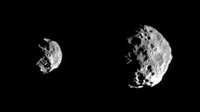
Original Caption Released with Image: Early images returned from the first detailed reconnaissance of Saturn's small outer moon, Phoebe, show breathtaking details in the moon's pockmarked surface that already have imaging scientists puzzling over the body's history. The images are only a preview of what to expect from the high resolution images to be examined later today which will show details about 10 times smaller.

Phoebe has revealed itself to be a rugged, heavily cratered body, with overlapping craters of varying sizes. This morphology suggests an old surface. There are apparently many craters smaller than 1 km, indicating that projectiles probably smaller than 100 meters once pummeled Phoebe. Whether these objects were cometary or asteroidal in origin, or were the debris that resulted from impacts on other bodies within the Saturn system, is hotly debated. There is also variation in surface brightness across the body.

In the first image (at left) in which Phoebe looks somewhat like a sideways skull, the large crater near the bottom displays a complex and rugged interior. The lower right hand part of Phoebe appears to be covered by bright wispy material.

The second, higher resolution image further reveals the moon's battered surface, including a crater near the right hand edge with bright rays that extend outward from its center. This suggests that dark material coats the outside. Features reminiscent of those seen on the Martian moon Phobos -- such as linear grooves--are faintly visible in the upper part of this image. There are suggestions of linear ridges or grooves and of chains of craters, perhaps radial to a large crater just hidden on the un-illuminated region in the upper left.

Left to right, the two views were obtained at phase, or Sun-Phoebe-spacecraft, angles of approximately 86 degrees, and from distances ranging from 143,068 kilometers (88,918 miles) to 77,441 kilometers (48, 130 miles); for reference, Cassini's closest approach to Phoebe was approximately 2,068 kilometers (1,285 miles). The image scale ranges from 0.86 to 0.46 kilometers (0.53 to 0.29 miles) per pixel. No enhancement of any kind has been performed on the images.

The Cassini-Huygens mission is a cooperative project of NASA, the European Space Agency and the Italian Space Agency. The Jet Propulsion Laboratory, a division of the California Institute of Technology in Pasadena, manages the Cassini-Huygens mission for NASA's Office of Space Science, Washington, D.C. The Cassini orbiter and its two onboard cameras, were designed, developed and assembled at JPL. The imaging team is based at the Space Science Institute, Boulder, Colo.

For more information, about the Cassini-Huygens mission visit, saturn.jpl.nasa.gov and the Cassini imaging team home page, ciclops.org. Image Credit: NASA/JPL/Space Science Institute

NASA images generally are not copyrighted. Unless otherwise noted, images and video on JPL public web sites (public sites ending with a jpl.nasa.gov address) may be used for any purpose without prior permission. The endorsement of any product or service by Caltech, JPL or NASA must not be claimed or implied.

Leave a comment, make a request, Let this small sampling be a guide to better quality, more plentiful, public domain, royalty free, copyright free, high resolution, images, stock photos, jpeg, jpg, free for commercial use, clip art, clipart, clip-art. more at and or and or and or and or

Sunday, July 09, 2006

Space the Final Frontier, Saturn, Pandora

Target Name: S Rings, Is a satellite of: Saturn, Mission: Cassini, Spacecraft: Cassini Orbiter, Instrument: Imaging Science Subsystem - Narrow Angle, Product Size: 992 samples x 908 lines.Target Name: S Rings, Is a satellite of: Saturn, Mission: Cassini, Spacecraft: Cassini Orbiter, Instrument: Imaging Science Subsystem - Narrow Angle, Product Size: 992 samples x 908 lines.
Produced By: Cassini Imaging Team, Primary Data Set: Cassini, Full-Res JPEG: PIA07628.jpg (34.78 kB)

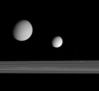
Original Caption Released with Image: This excellent grouping of three moons -- Dione, Tethys and Pandora -- near the rings provides a sampling of the diversity of worlds that exists in Saturn's realm.

A 330-kilometer-wide (205 mile) impact basin can be seen near the bottom right on Dione (at left). Ithaca Chasma and the region imaged during the Cassini spacecraft's Sept. 24, 2005, flyby can be seen on Tethys (middle). Little Pandora makes a good showing here as well, displaying a hint of surface detail.

Tethys is on the far side of the rings in this view; Dione and Pandora are much nearer to the Cassini spacecraft.

Dione is 1,126 kilometers (700 miles) across. Tethys is 1,071 kilometers (665 miles) across and Pandora is 84 kilometers (52 miles) across.

This image was taken in visible blue light with the Cassini spacecraft narrow-angle camera on Sept. 22, 2005, at a distance of approximately 1.2 million kilometers (800,000 miles) from Saturn. The image scale is about 5 kilometers (3 miles) per pixel on Dione and Pandora and 9 kilometers (6 miles) per pixel on Tethys.

The Cassini-Huygens mission is a cooperative project of NASA, the European Space Agency and the Italian Space Agency. The Jet Propulsion Laboratory, a division of the California Institute of Technology in Pasadena, manages the mission for NASA's Science Mission Directorate, Washington, D.C. The Cassini orbiter and its two onboard cameras were designed, developed and assembled at JPL. The imaging operations center is based at the Space Science Institute in Boulder, Colo.

For more information about the Cassini-Huygens mission visit, saturn.jpl.nasa.gov. The Cassini imaging team homepage is at ciclops.org,. Image Credit: NASA/JPL/Space Science Institute

NASA images generally are not copyrighted. Unless otherwise noted, images and video on JPL public web sites (public sites ending with a jpl.nasa.gov address) may be used for any purpose without prior permission. The endorsement of any product or service by Caltech, JPL or NASA must not be claimed or implied.

Leave a comment, make a request, Let this small sampling be a guide to better quality, more plentiful, public domain, royalty free, copyright free, high resolution, images, stock photos, jpeg, jpg, free for commercial use, clip art, clipart, clip-art. more at and or and or and or and

Saturday, July 08, 2006

Space the Final Frontier, Saturn, Mimas

Target Name: Mimas, Is a satellite of: Saturn, Mission: Cassini, Spacecraft: Cassini Orbiter, Instrument: Imaging Science Subsystem - Narrow Angle, Product Size: 1020 samples x 1020 lines.Target Name: Mimas, Is a satellite of: Saturn, Mission: Cassini, Spacecraft: Cassini Orbiter, Instrument: Imaging Science Subsystem - Narrow Angle, Product Size: 1020 samples x 1020 lines.
Produced By: Cassini Imaging Team, Primary Data Set: Cassini, Full-Res JPEG: PIA08172.jpg (40.13 kB)

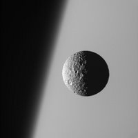
Original Caption Released with Image: This amazing perspective view captures battered Mimas against the hazy limb of Saturn.

It is obvious in such close-up images that Mimas (397 kilometers, or 247 miles across) has been badly scarred by impacts over the eons. Its 130 kilometer- (80 mile-) wide crater, Herschel, lies in the darkness at right.

North on Mimas is up and rotated 19 degrees to the right.

The image was taken with the Cassini spacecraft narrow-angle camera on March 21, 2006 using a filter sensitive to wavelengths of ultraviolet light centered at 338 nanometers. The image was acquired at a distance of approximately 191,000 kilometers (119,000 miles) from Mimas and at a Sun-Mimas-spacecraft, or phase, angle of 91 degrees. Image scale is 1 kilometer (3,730 feet) per pixel.

The Cassini-Huygens mission is a cooperative project of NASA, the European Space Agency and the Italian Space Agency. The Jet Propulsion Laboratory, a division of the California Institute of Technology in Pasadena, manages the mission for NASA's Science Mission Directorate, Washington, D.C. The Cassini orbiter and its two onboard cameras were designed, developed and assembled at JPL. The imaging operations center is based at the Space Science Institute in Boulder, Colo.

For more information about the Cassini-Huygens mission visit saturn.jpl.nasa.gov/. The Cassini imaging team homepage is at ciclops.org/.

Image Credit: NASA/JPL/Space Science Institute

NASA images generally are not copyrighted. Unless otherwise noted, images and video on JPL public web sites (public sites ending with a jpl.nasa.gov address) may be used for any purpose without prior permission. The endorsement of any product or service by Caltech, JPL or NASA must not be claimed or implied.

Leave a comment, make a request, Let this small sampling be a guide to better quality, more plentiful, public domain, royalty free, copyright free, high resolution, images, stock photos, jpeg, jpg, free for commercial use, clip art, clipart, clip-art. more at and or and or and or and or

Friday, July 07, 2006

Space the Final Frontier, Saturn 2

Target Name: Saturn, Is a satellite of: Sol (our sun), Mission: Cassini, Spacecraft: Cassini Orbiter, Instrument: Imaging Science Subsystem - Narrow Angle, Product Size: 1824 samples x 1360 lines, Produced By: CICLOPS/Space Science Institute.Target Name: Saturn, Is a satellite of: Sol (our sun), Mission: Cassini, Spacecraft: Cassini Orbiter, Instrument: Imaging Science Subsystem - Narrow Angle,
Product Size: 1824 samples x 1360 lines, Produced By: CICLOPS/Space Science Institute. Primary Data Set: Cassini, Full-Res JPEG: PIA06077.jpg (74.84 kB)

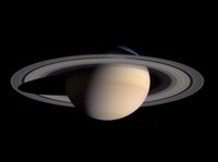
Original Caption Released with Image: Saturn's peaceful beauty invites the Cassini spacecraft for a closer look in this natural color view, taken during the spacecraft's approach to the planet. By this point in the approach sequence, Saturn was large enough that two narrow angle camera images were required to capture an end-to-end view of the planet, its delicate rings and several of its icy moons. The composite is made entire from these two images.

Moons visible in this mosaic: Epimetheus (116 kilometers, 72 miles across), Pandora (84 kilometers, 52 miles across) and Mimas (398 kilometers, 247 miles across) at left of Saturn; Prometheus (102 kilometers, 63 miles across), Janus (181 kilometers, 113 miles across) and Enceladus (499 kilometers, 310 miles across) at right of Saturn.

The images were taken on May 7, 2004 from a distance of 28.2 million kilometers (17.6 million miles) from Saturn. The image scale is 169 kilometers (105 miles) per pixel. Moons in the image have been brightened for visibility.

The Cassini-Huygens mission is a cooperative project of NASA, the European Space Agency and the Italian Space Agency. The Jet Propulsion Laboratory, a division of the California Institute of Technology in Pasadena, manages the Cassini-Huygens mission for NASA's Office of Space Science, Washington, D.C. The Cassini orbiter and its two onboard cameras, were designed, developed and assembled at JPL. The imaging team is based at the Space Science Institute, Boulder, Colo.

For more information, about the Cassini-Huygens mission visit, saturn.jpl.nasa.gov and the Cassini imaging team home page, ciclops.org. Image Credit: NASA/JPL/Space Science Institute

NASA images generally are not copyrighted. Unless otherwise noted, images and video on JPL public web sites (public sites ending with a jpl.nasa.gov address) may be used for any purpose without prior permission. The endorsement of any product or service by Caltech, JPL or NASA must not be claimed or implied.

Leave a comment, make a request, Let this small sampling be a guide to better quality, more plentiful, public domain, royalty free, copyright free, high resolution, images, stock photos, jpeg, jpg, free for commercial use, clip art, clipart, clip-art. more at and or and or and or and