


USGS ~ science for a changing world, Mount St. Helens, Washington, Eruption Images, 2004 and 2005, Memorable Images of "The First Year"
 | MSH05 aerial st helens with plume from south 03-08-05, Aerial view, Mount St. Helens with plume, as seen from the south. Mount Rainier, Washington, is in the background. USGS Photograph taken March 8, 2005, by John Pallister. |
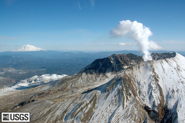 | MSH05 aerial st helens adams from west 02-25-05, Aerial view of a steaming Mount St. Helens with Mount Adams in the background. USGS Photograph taken on February 25, 2005, by Mike Doukas and Julie Griswold, |
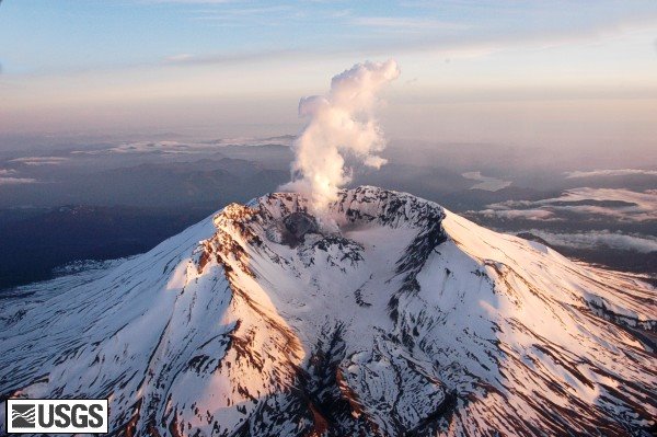 | MSH05 aerial mount st helens from north 04-26-05 Sunset, Mount St. Helens from the north. USGS Photograph taken on April 26, 2005, by John Pallister. |
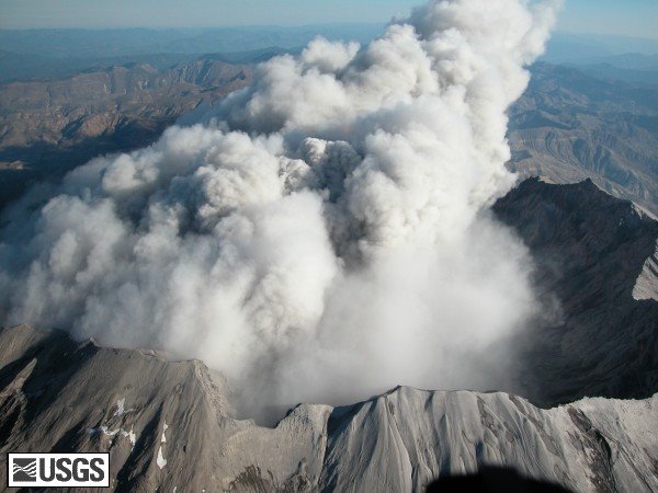 | MSH04 crater rim plume 0929PDT 10-05-04, Aerial view of Mount St. Helens' crater rim and recent plume, from the south. USGS Photograph taken on 5 October 2004 at 09:29:21 PDT, by Steve Schilling. |
 | MSH05 mount st helens hood jefferson 06-08-05, Aerial view of Mount St. Helens from the north, with Mount Hood (left) and Mount Jefferson (right) on the horizon. USGS Photograph taken on June 8, 2005 by John Pallister. |
The maps, graphics, images, and text found on our website (USGS), unless stated otherwise, are within the Public Domain. You may download and use them. Credit back to the USGS/Cascades Volcano Observatory is appreciated.
Generally speaking, works created by U.S. Government employees are not eligible for copyright protection in the United States. See Circular 1 "COPYRIGHT BASICS" from the U.S. Copyright Office.
Anyone incorporating a work of the U.S. Government into a copyrighted work should be aware of 17 U.S.C. § 403. This section requires a copyright notice to contain a statement identifying what portions of the work consist of a work of the U.S.Government.
Technorati tags: Public Domain Clip Art and clip art or public domain and Weather or USGS and Cascades Volcano Observatory or Mount St. Helens and vulcan or U.S. Geological Survey and Volcanos


No comments:
Post a Comment